Today’s Adventure: Manning Park first pass
I’ve been itching to get out of the city for a while, and a long weekend is a good chance for that. I’ve had my eye on Manning Park for a while – ever since I noticed on Google Earth that there appears to be a road going all the way up one of the mountains off Highway 3. I figured there would be some good views from there, as confirmed by finding other peoples’ photos from that road.
I had also noticed some nice scenery in the area last time I passed through, on my way home from vacation in Calgary a couple of years ago. But the scenery is very weather-dependent. I thought it would look good under snow or fog, or in the fall. So I set up an overnight job to record every image from the only road conditions camera in the park. Flipping through them this morning it looked like the park got a good snowfall overnight but the road was clearing up nicely, so off I went.
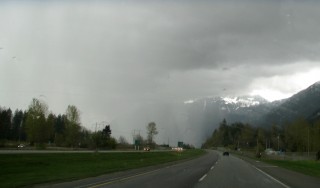
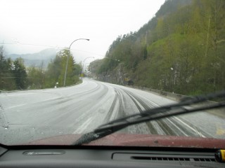
It was overcast but dry most of the way, but as I reached Hope I ran into a serious hailstorm. Small pellets, but lots of them hammering my windshield. I had to slow down due to poor visibility, the road being covered with ice pellets and slush building up on my windshield and hood too.
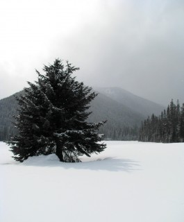
Opon reaching the park I was rewarded with nicely snow-covered trees, clearing skies and clean road. But I was disappointed to learn that the lookout road is only open July to September. I couldn’t find that information online anywhere – shame I had to drive 150 miles to learn it, but I’m still glad I did.
So I went to the Lightning Lake day use area and did some trudging around in the two feet of snow. Got a handful of OK pictures.
See also today’s 365 entry.
Then started heading back. By the time I reached the Hope Slide area I met that storm again, only now it was a blizzard. I was driving through whiteout conditions for a while. It was gorgeous.
 The sky mostly cleared up and the sun came out at Hope. Took the Lougheed Highway home from there for a change of scenery. End of story.
I really enjoyed this outing and I spotted a bunch of beautiful pictures that I couldn’t get because there was no place handy to stop on my side of the road. I must go back and do this stretch of road again in the summer (to get the lookout) and proper winter to get the things I spotted along the road.
[gmap file=’http://www.soleillapierre.ca/blog/wp-content/uploads/2010/04/20100403.kmz’]
Long Beach vacation day 5
Wednesday October 14, 2009.
My goals for today were to walk the lengh of Combers Beach (the next one south of Long Beach) and to visit Schooner Cove, which is where my parents lived and where (I just learned) I was conceived.
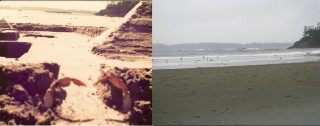
A digression first: Before I embarked on this vacation, I looked through my photos to try and find pictures from my childhood visit to Long Beach, with the intent of rephotographing them. I only found one, which was a picture of a sand castle I made as a child with some islands in the background. Yesterday I didn’t spot any locations that might have been it, but today with a bit of a shock I spotted those islands right outside my resort cabin! Confirmed by phone with my mother: we stayed at a campground that is just up the beach from where I am now. Here are the original and rephotographed versions side by side (no sand castle this time; not because I didn’t want to make one but because it was cold and rainy and I don’t have any suitable clothes for scrambling around in the sand):
It was interesting to reflect on standing in the same place almost two decades later, but it didn’t really give me the same cognitive dissonance effect that you might expect; not much has changed here and the site wasn’t really familiar enough to me. It’d be different if this were a place I had spent years and a lot of the surroundings had changed. Anyway, end of rephotography digression.
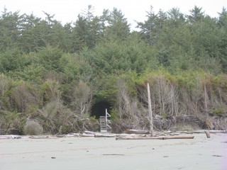
So I went down to Combers Beach. The walk down from the parking lot went through a tunnel through a dark and scary bunch of trees. These trees were so competitive and yet so stunted by the constant strong wind and sand and salt blasting they get that almost no light gets through their canopy. There is no undergrowth:
When I reached the beach the tide was high but on its way out. It was reaching almost to the end of the path, but by the time I got back it was out far enough to take the photo above.
I walked north first, all the way back to Green Point, and climbed on the rocks again a bit. I had been expecting it to be really rainy here based on the weather at the resort this morning, so I put a rain jacket over top of my warm jacket and also put on rain pants. This will become important later. The weather at Combers Beach was quite different though; it was dry (almost no rain) with a very high wind; there were sheets of sand blowing along the beach and making small dunes around the driftwood. The sun actually broke through the clouds a few times.
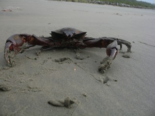
Saw a couple more beached jellyfish and also a live crab of a species I haven’t encountered before:
I was going to continue south on the beach past where I entered, but I was quickly blocked by a small river crossing the beach, too deep to cross without getting my feet soaked. Checking my map later, I discovered that the section south of this river is called Wickaninnish Beach and is accessible from another parking lot – maybe something for tomorrow. So onward to my next destination: Schooner Cove.
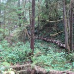 Access to Schooner Cove from the nearest parking lot is via a trail that skirts the edge of the nearby indian reservations. The trail is the most incredible boardwalk I’ve ever seen. It’s a full kilometer long and has a lot of ups and downs, even dipping in and out of a small canyon at one point. Very Ewok village. However, I rather doubt this is how my parents used to reach the cove when they lived here, and on checking by phone afterwards it seems they used to cut right through the reservation. Oh well.
Remember I mentioned the rain pants earlier? Yeah. Since it was windy, dry and not too cold at Combers Beach, I took them off and switched back to a camera that couldn’t be safely stowed in a pocket. Mistake. As soon as I reached the water here I found myself in an incredible downpour. Just a plain, no-nonsense soaker. I was soaked to the bone within half a minute and having a very difficult time keeping water out of my camera.
Also the tide was still a bit high here and it didn’t look like I could get very far even without the rain. So I turned around and trudged back up the kilometer of stairs to the parking lot, and headed back to the resort for a hot shower and a dry-off. Only the power was out when I got there. Damn! So I just put on dry clothes and went into Tofino to explore.
Not much to say about that. Like Ucluelet, it’s a small town with a heavy emphasis on tourist-soaking. They do seem to get a lot of custom from the natives who come and go by boat from here though.
Several of the local business were running on gas generators; I guess power failures are not uncommon here either. I picked up some snacks at the local bakery, The Common Loaf, then noticed the sky was clearing up.
I rushed back to the resort with the intention of trying to take a time-lapse movie of the sunset. I actually would have loved to make a movie of the tide coming in and out at Long Beach, but there was nowhere to get enough power for that. I will think about portable power solutions for the future. The power did come back on while I was filming, which is why there is a slight frame skip partway through this movie, and it did cloud over again before sunset, but presented anyway is this experiment: 900 frames at 5 seconds per frame, covering a span of 75 minutes – so about 150 times realtime. d20091014c.avi – it’s high-def, so best to save locally before playing. If you’re missing the codec, it’s called “h.263+”.
End of second full beach day. Today’s GPS track:
[gmap type=”satellite” width=”80%” zoom=”auto” center=”files” file=’__UPLOAD__/2009/10/20091014.kmz’]
Long Beach vacation day 4
Tuesday October 13, 2009.
Today was my first full day on the beach. Had a quick breakfast and then headed out to Long Beach proper. (There are several beaches between Tofino and Ucluelet and each has its own name. Long Beach is the longest stretch of sand unbroken by rock outcrops). Here’s my first view of the beach since I was a little kid:
Darkening of the sand near the middle is partly moisture and partly due to me shooting this panorama with autoexposure on; that’s where the sun was brightest. I think that rock near the middle is where my father crashed his car when my parents lived here. More research needed. Incidentally, when I was trying to create this panorama, Autostitch freaked out in an interesting way I haven’t seen before, and produced this work of computer-generated art:
I walked to Incinerator Rock at the north end of the beach. From there it looked like about a mile to Green Point at the south end, so I decided to walk the whole length. Wow, distance is very deceptive here – this beach is almost two and a half miles long. Normally that wouldn’t be a problem, but I had brought my full camera bag with me, including my film camera and my best lenses for it. Heavy. By the time I got back to the parking lot I was really bagged, and wishing I had equipped Sandvich for this outing.
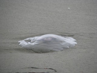
During the walk I alternated between following the tide line looking for interesting debris, and either looking at the driftwood at the global high tide mark or taunting the sea by walking just out of its present reach (never once misjudged how far a wave would reach). Didn’t find any interesting shells along the tide line, but I did find about a dozen jellyfish of two or maybe three species. This one’s a moon jelly, about a foot in diameter:
Naturally I prodded them with my walking stick (slash monopod; highly useful) hoping to elicit an appropriate tentacular-horror response, but they were all motionless. Sullen about failing their migration back to their forest home, I imagine.
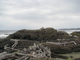
When I got to Green Point at the south end of the beach I did some climbing on the rocks and looking into tidal pools. Found one pool with a lot of small anemones in it, but they weren’t very colorful. Also on top of one of the rocks there was a very permanent-looking surfer shelter made of driftwood. Might be fun to spend a stormy evening in one of those.
When I got back to the parking lot I was really hungry, so I drove down to explore Ucluelet and get some eats. Not much to say about Ucluelet; small town with mainly tourist-driven commerce and some local-scale fishing. I ate at Ukee Dogs, which is a local hole-in-the-wall specializing in hot dogs. I had their signature dish, which is a baked frank in a hoagie bun loaded with fried onions and bean chili, with grated cheddar on top. Good stuff; I will eat here again.
There’s a lighthouse at the south end of Ucluelet with a park around it. I went for a walk there and enjoyed a bit of coastal breeze – the wind was really picking up and driving a heavy rain. Watched the waves crashing on ship-wrecking rocks for a while.
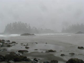
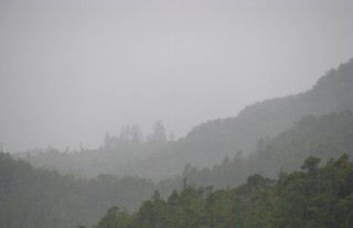
Then I headed up to Radar Hill to see what the view was like. Not spectacular due to the weather, and there were cougar warnings posted that made me a bit nervous (hardly any other tourists around, and I’m so sweet and tasty), so I didn’t stay too long. I do rather like this picture though:
Went back to Incinerator Rock for a while to have a look at the next beach north, but by then it was getting on so I went back to the resort for the evening. End of beach day one.
Today’s GPS track:
[gmap type=”satellite” width=”80%” zoom=”auto” center=”files” file=’__UPLOAD__/2009/10/20091013.kmz’]
Long Beach vacation day 2
Sunday October 11, 2009.
Today I tried to catch up with some of the Victoria tourism I had planned. The two main items on my itinerary for today were the Butchart Gardens and the Butterfly Gardens right next door.
Butchart Gardens was smaller than I remember, but then I was a lot smaller last time I was there. Rewarding though, and I got some good pictures, but too many to upload over the wireless from where I am right now; I’ll post them to the gallery after I return home.
Butterfly Gardens was a bit of a disappointment, but only because I’ve recently been to the Vancouver Aquarium, which also has butterflies on exhibit. Butterfly Garden had two or three species not represented at VanAqua, but that’s not enough to get me excited about it.
After that I went to Russell Books; I missed them yesterday, but luckily they were also open today. Got there about an hour before closing, but they’ve got so much stuff I could spend a whole afternoon browsing. Did come away with:
- “The Art of Science Fiction” by Frank Kelly Freas
- “Revolutionary” by S. Andrew Swann
- “Engines of Creation” by K. Eric Drexler
- “The Singularity is Near” by Ray Kurzweil
- “The Demon-Haunted World” by Carl Sagan
That last is a second copy; I’m currently reading this book, and it has a sufficient combination of rarity and value that I picked up a second copy to give to someone. I don’t know who I’m going to give it to yet (speak up if you want it), but I think it’s a must-read for anyone who has trouble drawing the line between fact and fiction or between science and faith, or for anyone who interacts with people who have those troubles.
By then it was supper time so I met up with Mike and we went out to a local color joint called John’s Place and had a good meal and chat, then went to look at a few nighttime sights before calling it a day.
Today’s GPS track, with internal foot-tour detail of the Butchart Gardens:
[gmap type=”satellite” width=”80%” zoom=”auto” center=”files” file=’__UPLOAD__/2009/10/20091011.kmz’]
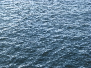
Wow that looks fake!
Water ripples as seen from the (docked) ferry at Tswassen on Saturday. I’ve often thought that procedural noise water textures in video games etc look fake, but they look an awful lot like this sometimes. So I guess they are accurate for some values of water.
